Evaluating Autonomous Flight Path Planning for Unmanned Aerial Vehicles (UAVs)
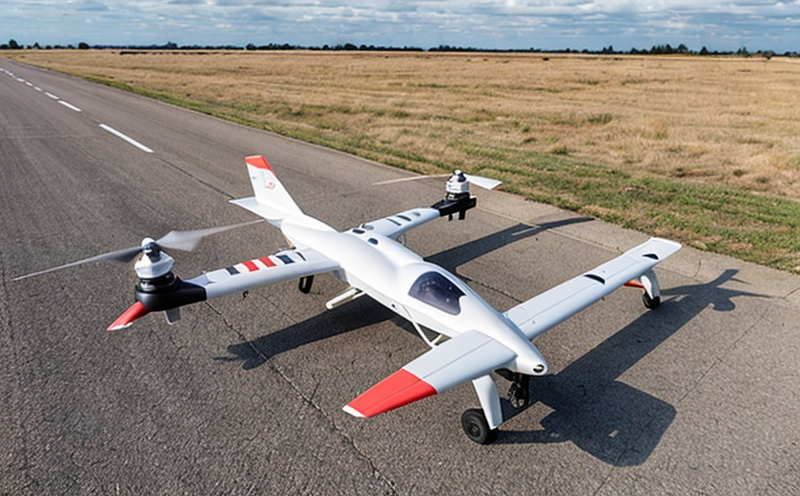
The increasing demand for efficient and precise flight operations in various industries has led to the development of autonomous flight path planning for UAVs. This technology enables drones to navigate through complex environments without human intervention, making them ideal for applications such as surveillance, inspection, and package delivery.
Autonomous flight path planning involves the use of algorithms and software that generate optimal flight paths for UAVs based on their mission requirements, environmental conditions, and safety considerations. The goal is to ensure that the UAV reaches its destination efficiently while minimizing risks and avoiding obstacles.
One of the key challenges in developing autonomous flight path planning systems is balancing the trade-off between efficiency and safety. On one hand, more efficient routes can result in shorter flight times and lower fuel consumption. However, this may compromise on safety if the route takes the UAV through congested areas or near sensitive infrastructure.
On the other hand, prioritizing safety may require taking longer routes to avoid hazards, which can increase flight time and fuel consumption. To address this challenge, developers must carefully evaluate the performance of their autonomous flight path planning systems using metrics such as mission completion rate, fuel efficiency, and safety metrics like collision avoidance and obstacle detection.
Here are some key considerations for evaluating autonomous flight path planning systems:
Mission Requirements: The primary goal of any UAV mission is to collect relevant data or perform a specific task. Autonomous flight path planning systems must be designed to prioritize this objective while ensuring that the UAV completes its mission within the allotted time and resource constraints.
Environmental Conditions: Weather, terrain, and other environmental factors can significantly impact the performance of autonomous flight path planning systems. Developers must take into account wind direction and speed, air density, temperature, and humidity when designing their algorithms to ensure optimal performance under various conditions.
Some common techniques used in autonomous flight path planning include:
Graph-Based Methods: These methods represent the environment as a graph where nodes represent waypoints or locations of interest, and edges represent possible paths between them. The algorithm then searches for an optimal path that minimizes time, fuel, or other metrics.
Probabilistic Methods: These methods use probability distributions to model uncertainty in the environment, such as wind patterns or obstacle positions. They can provide more robust and adaptive flight planning capabilities.
Machine Learning-Based Methods: These methods train machine learning models on historical data to learn optimal flight paths for specific scenarios or environments.
Heres a detailed explanation of graph-based methods:
Graph Construction:
The environment is represented as a weighted graph, where each node represents a waypoint or location of interest.
Edges between nodes represent possible paths and are associated with weights that reflect the cost (time, fuel, etc.) of traversing them.
Path Search Algorithms:
Dijkstras algorithm is often used to find an optimal path from a starting node to all other nodes in the graph.
A\
search algorithm is another popular method that incorporates heuristics (estimated distances) to guide the search towards more promising areas of the graph.
Heres a detailed explanation of probabilistic methods:
Uncertainty Modeling:
Probability distributions are used to model uncertainty in environmental factors like wind direction and speed.
These models can be updated online using sensor data, enabling the algorithm to adapt to changing conditions.
Path Planning:
Probabilistic methods use techniques like Bayesian inference or Markov chain Monte Carlo (MCMC) to propagate uncertainty through the planning process.
The goal is to find a path that minimizes expected costs while accounting for uncertainty in environmental factors.
QA Section
1. What are some common applications of autonomous flight path planning?
Autonomous flight path planning has numerous applications across various industries, including:
Surveillance and monitoring: for tasks such as border patrol, wildlife tracking, or construction site inspection.
Package delivery: enabling faster and more efficient transportation of packages using drones.
Environmental monitoring: monitoring air quality, water quality, or tracking climate changes.
2. What are the benefits of autonomous flight path planning?
Autonomous flight path planning offers several advantages over traditional human-controlled flights:
Increased Efficiency: By automating flight planning, UAVs can complete missions faster and more efficiently.
Improved Safety: Automated systems reduce the risk of accidents caused by human error or weather conditions.
Enhanced Flexibility: Autonomous flight path planning enables drones to adapt quickly to changing mission requirements or environmental conditions.
3. What are some challenges associated with developing autonomous flight path planning systems?
Key challenges in developing these systems include:
Balancing Efficiency and Safety: Finding the optimal balance between completing missions efficiently while ensuring safety.
Handling Uncertainty: Accounting for uncertainty in environmental factors, such as wind patterns or obstacle positions.
Scalability and Adaptability: Ensuring that algorithms can adapt to changing mission requirements, environments, and sensor data.
4. What are some common techniques used in autonomous flight path planning?
Techniques include graph-based methods (e.g., Dijkstras algorithm), probabilistic methods (e.g., Bayesian inference), and machine learning-based methods (e.g., training models on historical data).
5. Can you explain the concept of uncertainty modeling in probabilistic methods?
Uncertainty modeling involves using probability distributions to represent uncertainty in environmental factors, such as wind direction and speed. These models can be updated online using sensor data, enabling the algorithm to adapt to changing conditions.
6. What are some potential risks associated with autonomous flight path planning systems?
Potential risks include:
Cybersecurity Risks: Unauthorized access or hacking of drone systems could compromise safety and efficiency.
Hardware Failure: Faulty sensors, propulsion systems, or communication equipment can cause accidents or mission failures.
Human Error: Misuse or misconfiguration of the system by human operators can lead to suboptimal performance or safety issues.
7. What is the role of sensor data in autonomous flight path planning?
Sensor data plays a crucial role in enabling adaptive and real-time decision-making in autonomous flight path planning:
Environmental Monitoring: Sensors provide real-time information about weather conditions, terrain, and obstacles.
Vehicle Health Monitoring: Sensors monitor drone health, including propulsion systems, communication equipment, and navigation.
8. How do machine learning-based methods contribute to autonomous flight path planning?
Machine learning models can be trained on historical data to learn optimal flight paths for specific scenarios or environments:
Supervised Learning: Training models on labeled datasets to predict the best course of action.
Unsupervised Learning: Identifying patterns in sensor data to inform decision-making.
9. Can you explain how graph-based methods handle obstacles and constraints?
Graph-based methods use a weighted graph representation of the environment, where nodes represent waypoints or locations of interest, and edges represent possible paths between them:
Obstacle Avoidance: The algorithm avoids obstacles by finding the shortest path that minimizes collision risk.
Constraint Satisfaction: The system ensures that mission constraints (e.g., time limits, fuel consumption) are satisfied.
10. What is the future outlook for autonomous flight path planning?
Advancements in AI, sensor technology, and edge computing will continue to improve the performance and adaptability of autonomous flight path planning systems:
Increased Adoption: Autonomous flight path planning is expected to become increasingly adopted across various industries.
Improved Performance: Advances in AI and machine learning will enable drones to navigate complex environments with greater efficiency and precision.