Modeling River Flow Changes from Infrastructure Projects
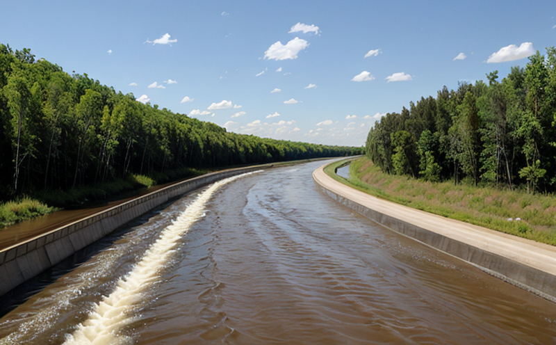
Infrastructure projects such as dams, canals, and levees are crucial for managing water resources and mitigating flood risks. However, these projects often have unintended consequences on river flow, affecting the surrounding environment, communities, and ecosystems. Modeling river flow changes is essential to understand the impact of infrastructure projects on the hydrological cycle and make informed decisions about their design and implementation.
What is River Flow Modeling?
River flow modeling involves using mathematical equations and computational techniques to simulate the movement of water in rivers. This process requires input data such as precipitation, evaporation, infiltration, and surface runoff, which are used to estimate river discharge, stage, and sediment transport. The output of river flow models can be used to predict changes in river flow due to various factors, including climate change, land use modifications, and infrastructure projects.
Why is River Flow Modeling Important?
River flow modeling has several applications in water resources management:
1. Flood risk assessment: Models can simulate flood events and estimate the likelihood of flooding downstream.
2. Water resource planning: Models help determine the availability of water for irrigation, municipal use, or industrial purposes.
3. Ecosystem assessment: Models evaluate the impact of infrastructure projects on aquatic ecosystems and suggest mitigative measures.
4. Design optimization: Models are used to optimize the design of infrastructure projects such as dams, canals, and levees.
How to Model River Flow Changes
To model river flow changes from infrastructure projects, follow these steps:
1. Data collection: Gather input data on precipitation, evaporation, infiltration, surface runoff, and existing infrastructure.
2. Model selection: Choose a suitable modeling framework, such as one-dimensional (1D) or two-dimensional (2D) models, depending on the complexity of the river system.
3. Parameter calibration: Adjust model parameters to match observed data, ensuring accurate simulation results.
4. Sensitivity analysis: Analyze the impact of changing input variables on the output, identifying critical factors influencing river flow.
5. Uncertainty quantification: Evaluate uncertainty in modeling outputs using statistical techniques.
Detailed Analysis of River Flow Modeling
One-Dimensional (1D) Models
Advantages:
- Easy to implement and calibrate
- Suitable for simple, straight channels
Disadvantages:
- Limited applicability for complex river systems
- Assumes uniform flow conditions
Applications: Designing canals, estuary management
Two-Dimensional (2D) Models
Advantages:
- Can capture complex channel morphology and hydraulic behavior
- Suitable for large-scale simulations
Disadvantages:
- Computational intensive
- Requires extensive calibration data
Applications: Simulating flood events, evaluating coastal erosion
QA Section
1.
What are the primary factors influencing river flow?
Precipitation, evaporation, infiltration, and surface runoff are the primary factors influencing river flow.
2.
How do infrastructure projects affect river flow?
Infrastructure projects such as dams, canals, and levees alter river flow by changing water storage capacity, increasing or decreasing discharge rates, and modifying channel morphology.
3.
What is the difference between 1D and 2D modeling approaches?
One-dimensional (1D) models assume uniform flow conditions and are suitable for simple channels, while two-dimensional (2D) models capture complex hydraulic behavior and can simulate large-scale events.
4.
How do you calibrate a river flow model?
Model calibration involves adjusting parameters to match observed data, typically using optimization techniques such as least squares or genetic algorithms.
5.
What are the benefits of uncertainty quantification in river flow modeling?
Uncertainty quantification helps identify critical factors influencing river flow and assesses confidence intervals for modeling outputs, ensuring more accurate predictions and decision-making.
6.
Can you use existing infrastructure data to model river flow changes?
Yes, using existing infrastructure data can help improve the accuracy of simulations by accounting for past changes in river flow due to infrastructure projects.
7.
How do you account for climate change impacts on river flow modeling?
Climate change projections are integrated into models using statistical downscaling techniques or scenario-based approaches, which estimate future precipitation and temperature trends.
8.
Can you use machine learning algorithms to improve river flow model accuracy?
Machine learning can be used to develop data-driven models that capture complex relationships between input variables and output responses, potentially improving modeling accuracy.
9.
What are the limitations of using simplified or reduced-complexity models for river flow simulations?
Simplified models may oversimplify channel behavior, neglecting critical factors such as hydraulic roughness or sediment transport. Reduced-complexity models can be less accurate due to decreased spatial resolution and increased computational efficiency.
10.
How do you validate the accuracy of a river flow model?
Model validation involves comparing simulated results with observed data using metrics such as Nash-Sutcliffe efficiency, percent bias, or mean absolute error (MAE).
In conclusion, modeling river flow changes from infrastructure projects is essential for understanding their impact on water resources management and ecosystem sustainability. By following the steps outlined in this article, users can select an appropriate modeling framework, calibrate model parameters, and evaluate uncertainty in outputs to ensure accurate predictions and decision-making.
Additional Resources
River Flow Modeling Software: Various software packages are available for river flow modeling, including HEC-RAS (US Army Corps of Engineers), SWMM (Storm Water Management Model), or TUFLOW (Tidal and Fluvial Hydrodynamics).
Data Sources: Access databases such as the United States Geological Survey (USGS) National Water Information System (NWIS) for precipitation, streamflow, and water quality data.
Model Development Tools: Utilize programming languages like Python, R, or MATLAB to develop custom models or integrate existing software packages.
Disclaimer
This article provides a general overview of river flow modeling concepts and techniques. It is essential to consult specific documentation, user guides, and technical references for each model or software package used in real-world applications.