Testing the Impact of Drilling Activities on Aquifers: A Comprehensive Approach
The extraction of groundwater through drilling activities has become increasingly common in recent years, driven by growing demand for water resources and the need to mitigate the effects of drought. While drilling can provide a vital source of water, it also poses significant risks to surrounding aquifers. In this article, we will explore the impact of drilling activities on aquifers, examine methods for testing their effect, and answer frequently asked questions related to this critical topic.
Understanding Aquifer Vulnerability
Aquifers are underground reservoirs of water that supply freshwater to millions of people worldwide. They are complex systems comprising layers of permeable rock or soil that allow water to flow through them, making it possible for human populations to access clean drinking water. However, drilling activities can pose a significant threat to these vital resources by:
Altering Groundwater Flow Patterns: Drilling operations can disrupt the natural flow patterns of groundwater, leading to changes in aquifer pressure and potentially causing water levels to decline or fluctuate irregularly.
Contaminating Water Sources: Drilling activities can also introduce contaminants into the surrounding environment, including drilling fluids, chemicals used for well maintenance, and other substances that can seep into nearby aquifers.
Methods for Testing Aquifer Vulnerability
To determine whether drilling activities are impacting local aquifers, various testing methods can be employed. Some of these include:
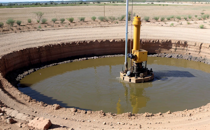
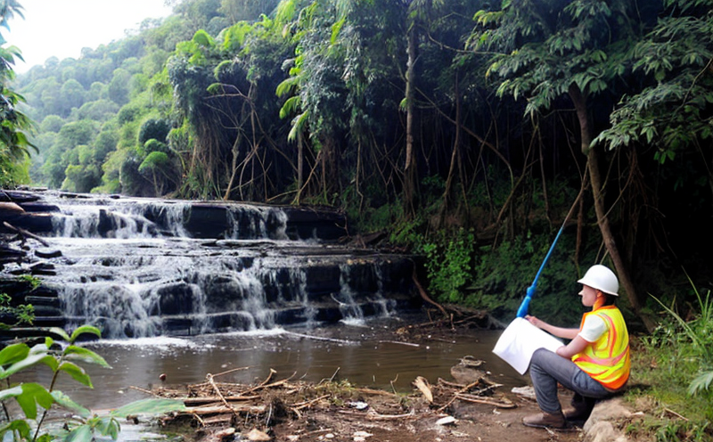
Groundwater Monitoring: Installing monitoring wells or sampling equipment allows scientists to collect data on groundwater levels, quality, and flow rates over time. This information helps identify any changes in aquifer behavior that may be linked to drilling activities.
Seismic Surveys: Seismic surveys use sound waves to image the subsurface geology of an area. By analyzing these images, researchers can determine if underground fractures or other features are present, which could potentially impact aquifer integrity.
Geophysical Logging: Geophysical logging involves using sensors and logging equipment to measure the physical properties of boreholes. This data helps identify potential problems with well construction or nearby drilling operations.
Implications for Drilling Operations
The results of testing can have significant implications for drilling operations, including:
Regulatory Actions: If testing reveals that drilling activities are negatively impacting local aquifers, regulatory bodies may impose stricter regulations on drilling practices or even halt operations altogether.
Enhanced Risk Assessment: Testing results can also inform the development of more comprehensive risk assessments, which help identify potential hazards associated with drilling and take steps to mitigate them.
QA Section
This section provides additional details on key topics related to testing the impact of drilling activities on aquifers.
Q: What are some common contaminants introduced by drilling operations?
A: Drilling fluids, chemicals used for well maintenance, and other substances can seep into nearby aquifers. These contaminants may include heavy metals, volatile organic compounds (VOCs), or other hazardous materials that can pose health risks to humans and wildlife.
Q: How do seismic surveys help assess aquifer vulnerability?
A: Seismic surveys use sound waves to create detailed images of underground geology. By analyzing these images, researchers can identify potential problems with aquifer integrity, such as fractures or voids that could allow water to escape or contaminants to enter.
Q: What is the role of groundwater monitoring in testing aquifer vulnerability?
A: Groundwater monitoring involves installing sampling equipment or monitoring wells to collect data on groundwater levels, quality, and flow rates over time. This information helps identify any changes in aquifer behavior that may be linked to drilling activities.
Q: Can geophysical logging help identify problems with well construction or nearby drilling operations?
A: Yes, geophysical logging involves using sensors and logging equipment to measure the physical properties of boreholes. This data can inform the development of more comprehensive risk assessments and help identify potential hazards associated with drilling.
Q: What happens if testing reveals that drilling activities are negatively impacting local aquifers?
A: Regulatory bodies may impose stricter regulations on drilling practices or even halt operations altogether. Testing results can also inform the development of more comprehensive risk assessments, which help identify potential hazards associated with drilling and take steps to mitigate them.
Conclusion
The extraction of groundwater through drilling activities has become increasingly common in recent years, driven by growing demand for water resources and the need to mitigate the effects of drought. While drilling can provide a vital source of water, it also poses significant risks to surrounding aquifers. By employing various testing methods, including groundwater monitoring, seismic surveys, and geophysical logging, scientists can determine whether drilling activities are impacting local aquifers and inform regulatory actions or risk assessments accordingly.